
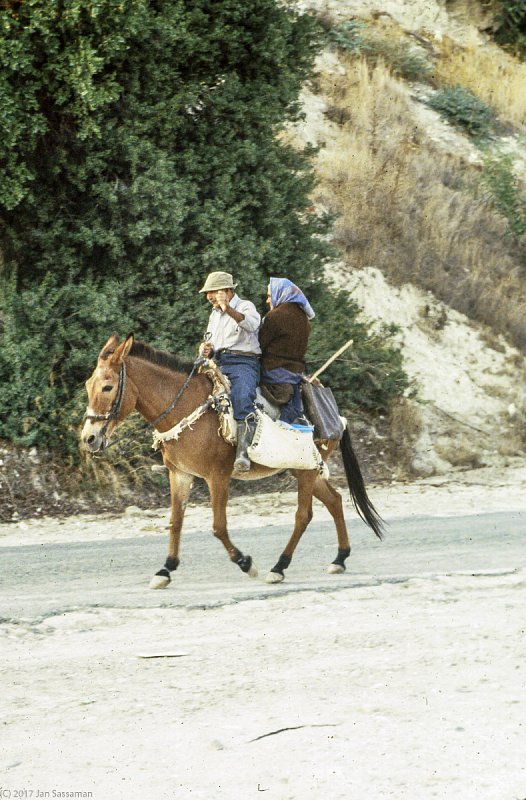
The Donkey at Work
Taken in 1988 near the Village of Lefkara in the south, this was a typical scene throughout Cyprus 50 years ago.
Taken in 1988 near the Village of Lefkara in the south, this was a typical scene throughout Cyprus 50 years ago.

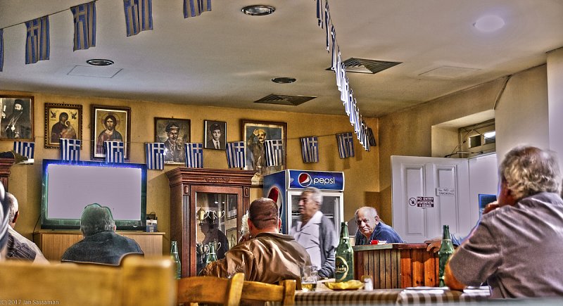
The Greek flag is more evident in this tavern in the mountains south of Nicosia, in an areas near where the EOKA resistance fighters found shelter from the British during the "troubles" of the 1950's.

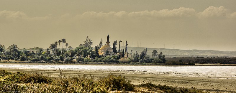
The Mosque of Umm Haram (Turkish: Hala Sultan Tekkesi) is a Muslim shrine in southern Cyprus, in the Greek zone, near the town of Larnaca. Umm Haram (Turkish: Hala Sultan) was Muhammad's wet nurse and according to at least one legend, died near this spot as a result of a fall from a camel.

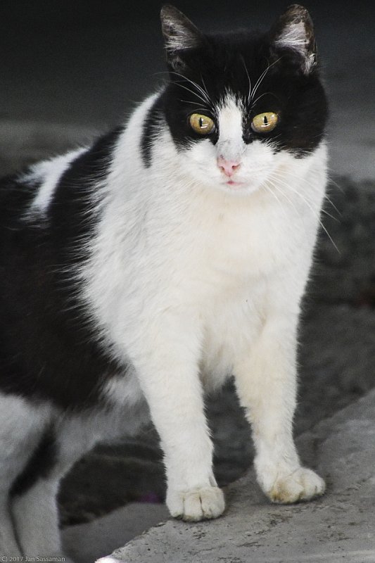
In Cyprus, both North and South, as well as throughout the Mediterranean, cats are ubiquitous. Archaeologists have reported finding evidence of a cat intentionally buried with a human some 9,500 years ago in a tomb from Cyprus. (www.sciencedaily.com/releas...)

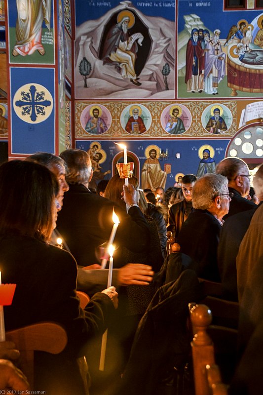
Easter is a significant holiday in the Greek Orthodox tradition, and associated celebrations include both church attendance, sometimes for hours, and meals, also sometimes for hours. In the evening of Saturday before Easter Sunday, there is a candlelight service at midnight when people bring a candle to be lit in church and then hopefully taken home still lit.

Who are the Cypriots? The people of Cyprus ultimately have come from all over the Eastern Mediterranean as well as Europe and to some extent, Asia.Historically, Cyprus has been conquered and occupied by many peoples - by people from the eastern cost of the Mediterranean as early as 8000 BCE, by the Greeks, the Persians, the Ptolemies, the Romans,the Byzantines, the Arabs, the Crusaders, the Franks, the Venetians, the Ottomans, and the British.All have contributed to the making of "the Cypriot", along with many other ethnic groups such as Armenians and Africans. And all have essentially, over generations, been assimilated into that culture which is the Cypriot.

With an adult literacy rate (2015) of just over 99 percent, education is an important part of Cypriot life. The English School was founded in 1900 and served for many years as, according to the school's website, "an English-medium, inter-communal school of Christian character with facilities for all pupils to practise their own form of religion." Until 1974, Turkish Muslim students attended the school, but in 1974 access to the school was no longer possible due to the Green Line. In 2003, access was again possible, and at present, there are a significant number of Turkish students who attend from "the other side."

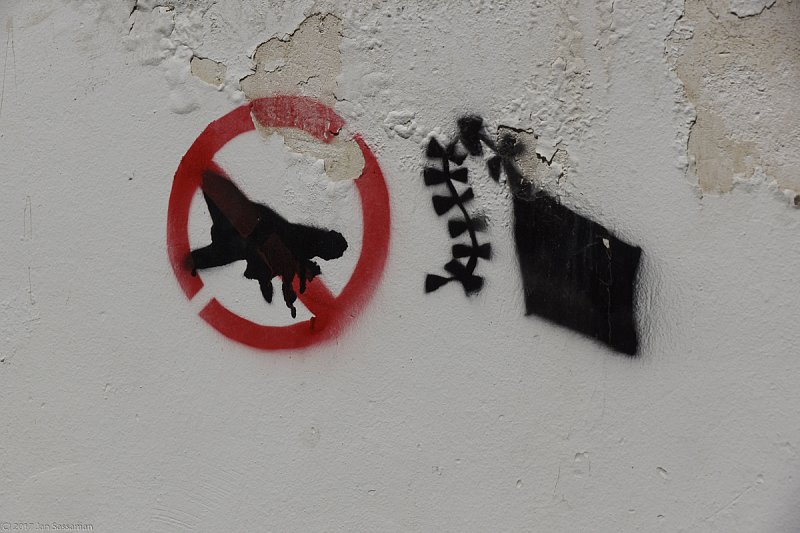
Sentiments against conflict can be seen on both sides of the buffer zone, some times, in the form of imaginative graffiti. This, along with several others, was on a wall in the northern side of Nicosia very close to the buffer zone.

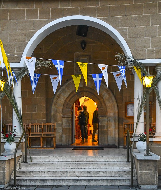
Again, banners representing the flags of Cyprus, Greece, and the Church, here at the entrance to a small church in the Nicosia suburb of Strovolos.

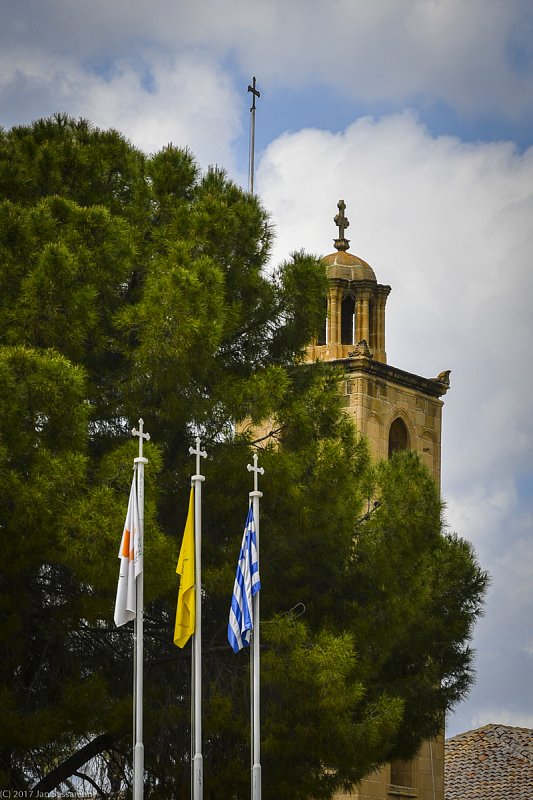
Three flags fly in front of the Archbishop's Palace in Nicosia - from lef to right, the flag of the Republic of Cyprus, a flag representing the Byzantine Empire (double-headed eagle on a yellow field, and the flag of Greece.

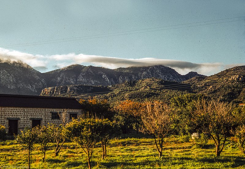
The main road from Kyrenia south to Nicosia as through the pass in the Pentadacytos Mountain range. This field, in front of our house, is now the site of a retail nursery operation. The building in the photo, once a jam factory, still stands.

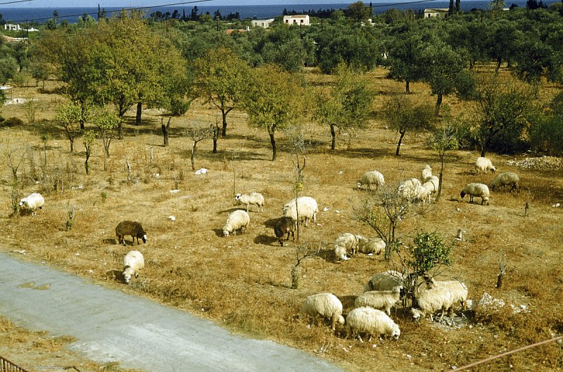
In 1960, grazing sheep in the open plots of land were a common sight in Kyrenia, as in this field adjacent to our house. The trees shown in the photo produced almonds. Now there is a large apartment house on this and several adjacent plots of land.

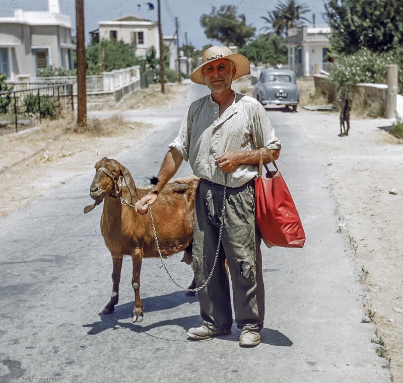
This man, probably a Turkish Cypriot posed for me beside our house in 1960. Down this street, about 100 yards, was the Turkish Quarter, where many of the local Turkish Cypriots lived. Further on down the street was the old Ottoman Town of Kyrenia, surrounding the harbor.

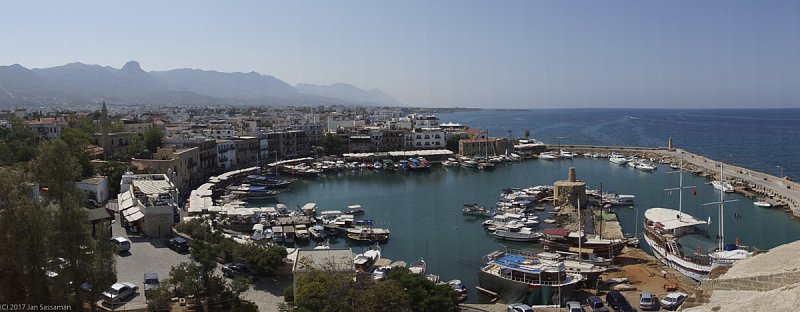
By 2012, the harbor is beginning to really fill up with pleasure boats, some fairly large. There are fewer working fishing boats, and the restaurants ringing the harbor have significantly increased.

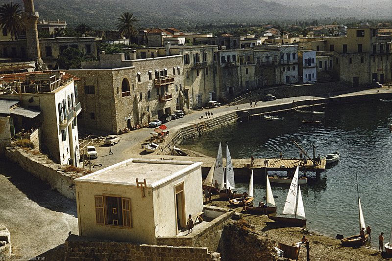
By 1988, Kyrenia Harbor had changed - larger boats had appeared, but the fishing boats were still there. A couple of restaurants d appeared along the harbor walkway.

When I left Cyprus in 1960, Kyrenia harbor was still a sleepy working port - small fishing boats, Andreas Kariolou's scuba and diving business, Sabrii Tahir''s new ice cream shop, the Harbor Club with its small recreational sail boats, and last but not least, the seasonal lighters (small boats) that were used to transport the karob crop to small freighters anchored offshore. The businessmen and boatmen here included both Greek and Turkish residents of Kyrenia.

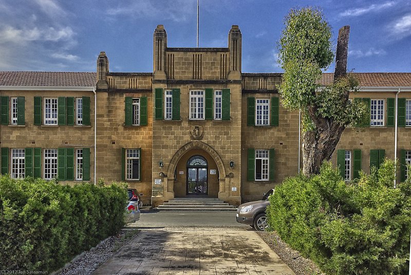
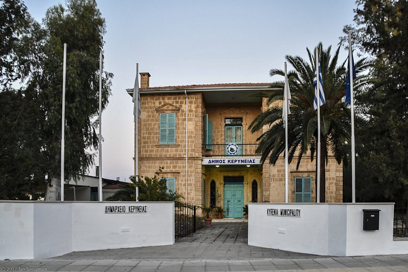
Kyrenia is an ancient port town located on the north coast. The town was reportedly founded before 1,000 BCE by Greeks from the Peloponnese and is in an area where human settlements from as early as the Neolithic Era have been unearthed. As of the Turkish invasion of 1974, there have been two municipal govenments for Kyrenia. The municipality de jure, Greek, is located in this building, is immediately south of the Green Line at the official Ledra Palace check point. The municipality de facto, Turkish, is located on the coast at the town itself, which is presently referred to as "Girne" by the Turkish speaking population..

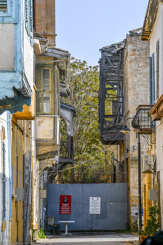
The wall from the northern side in the western part of Nicosia within the ancient city walls (map coordinates are inaccurate here). The buildings on the other side of the wall, in disrepair, are in the . buffer or no-man's zone and are presentlyabandoned.

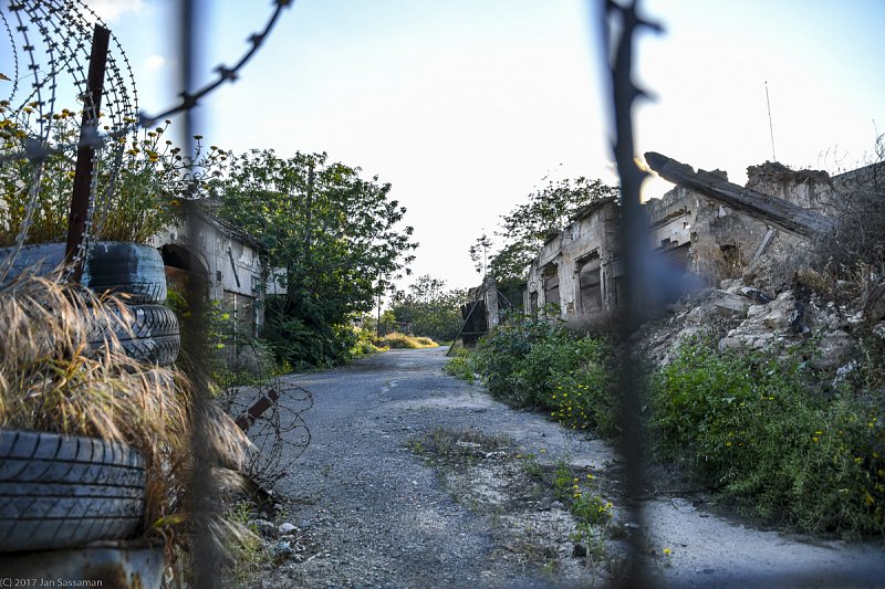
Ermou Street within the ancient walls of eastern Nicosia. In the mid-1900s, this was a thriving shopping area. Now, this stretch of Ermou is a 10 to 20-meter wide no man's land. or dead zone, between north and south Cyprus that is controlled by the United Nations.